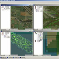
Creator Terrain StudioThe Creator Terrain Studio terrain generation software manages the process and workflow necessary to face the challenges and complexities of generating scalable terrain environments for real-time 3D applications.Delivering tools for creating superior synthetic environments, Creator Terrain Studio offers you the freedom to design a terrain database generation workflow with a hierarchical, top-down approach. By streamlining operations and enabling the seamlessly integration of powerful tools, this extensible toolset offers the most advanced terrain and imaging solutions available for real-time 3D modeling. In addition, the ability of Creator Terrain Studio to capture the 3D scene-building process allows you to design a database generation workflow using a hierarchical, top-down approach and to then run the entire workflow or any subset of it. Because the process is captured, it can be re-used on other applications, which saves time and increases productivity. Creator Terrain Studio also tracks and updates terrain building processes, allowing you to restart any process should it stop due to system failure or inadequate data. With Creator Terrain Studio, you can describe an entire 3D terrain database in the MetaFlight format—an XML-derived schema that describes the overall organization and structure of the data—and then publish the 3D scene in OpenFlight. The MetaFlight format facilitates the implementation of the real-time structure and hierarchy awareness of Creator Terrain Studio databases, improving paging efficiency and runtime configuration management. Creator Terrain Studio also provides the tools required for effectively re-using existing OpenFlight, TerraPage, and SGI Clip Texture databases. Existing databases can be optimized to take advantage of the performance and advanced rendering techniques of the Virtual Texture capability in Vega Prime. Features:
Software Options:
|
Contact us for pricing options and additional information:
(757) 498-6118 Ext - 101
Presagis GSA Schedule
|
|
| © Loyola Terrain Services 2012 | ||

A certified Service Disabled Veteran and Minority Owned Small Business.
